Alabama Historical Commission · Old Cahawba Archaeological Park
Cultural Resource Management
Professional Training Program
A five-week field school combining supervised archaeological fieldwork, laboratory practice, and one specialized training track.
Designed for students, recent graduates, and emerging archaeologists preparing for entry-level CRM employment, the program connects technical methods with the practical responsibilities of archaeological research, regulatory compliance, historic preservation, and public education.
Training within an active archaeological landscape
Administered by the Alabama Historical Commission, the program operates within Old Cahawba’s ongoing historic-site research and management work. At the confluence of the Alabama and Cahaba rivers, Alabama’s first state capital became an antebellum river town and, following emancipation, a significant center of African American community life.
Its archaeological deposits preserve evidence of Indigenous occupation, early statehood, slavery, the Civil War, Reconstruction, and generations of people who lived and worked along the rivers. Participants investigate this landscape while learning how archaeological evidence informs preservation and management decisions.
Who should apply?
- Current students or recent graduates in archaeology, anthropology, history, or closely related fields who are interested in a career in cultural resource management.
- Early-career professionals who do not yet have field experience.
Participants work with professional equipment, established documentation standards, and experienced archaeologists. Training is designed to meet the standards of the Register of Professional Archaeologists (RPA) and the Secretary of the Interior (SOI).
From field investigation to interpretation
Classroom instruction is integrated with fieldwork, laboratory processing, collaborative analysis, and professional presentations. Participants follow the project workflow from research design and data collection through artifact processing, interpretation, technical reporting, and public communication.
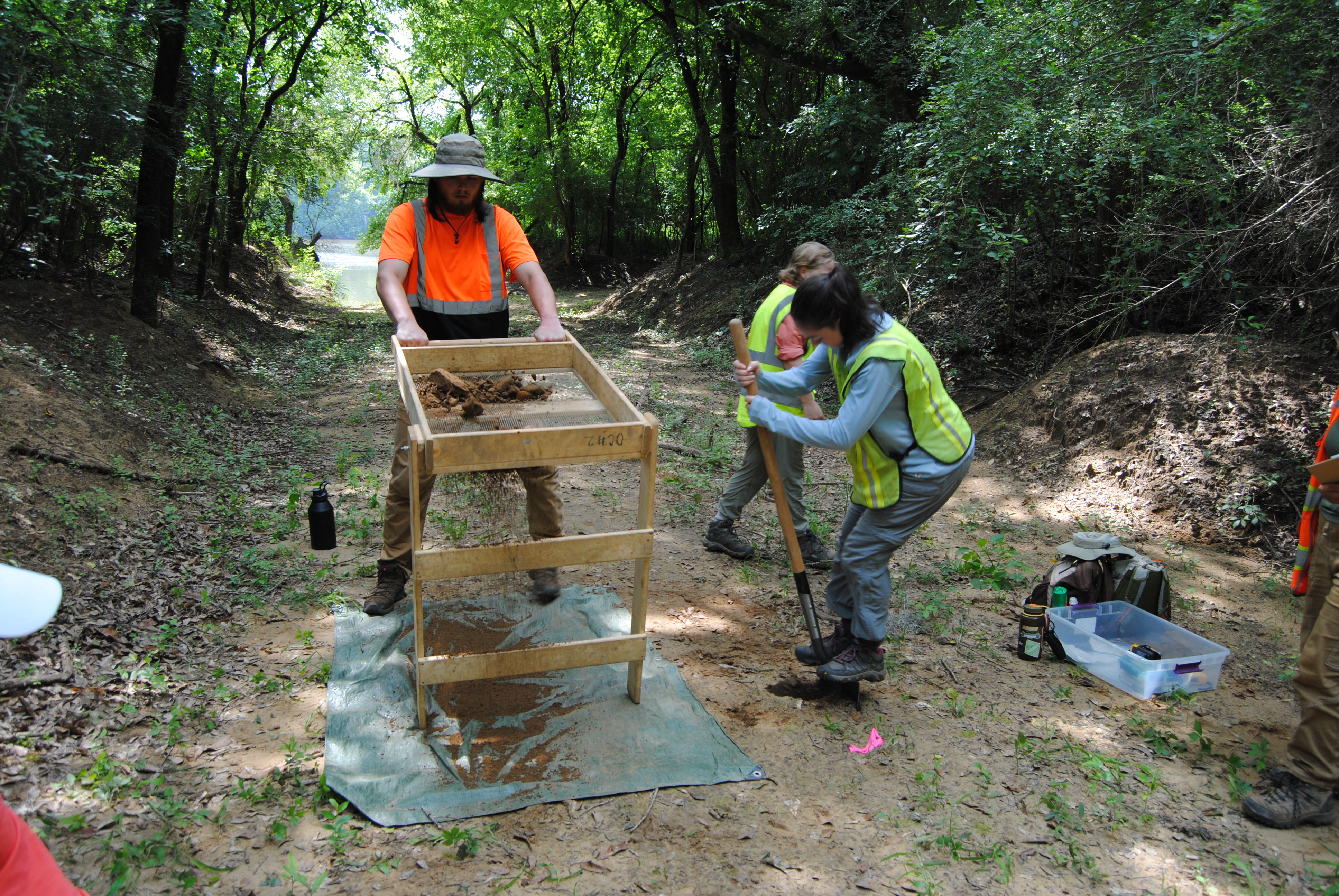
Supervised fieldwork includes Phase I survey through shovel testing and pedestrian reconnaissance, and Phase II evaluation through controlled test-unit excavation, feature investigation, and detailed stratigraphic documentation.
CRM law & compliance
The National Historic Preservation Act, the National Environmental Policy Act, relevant state preservation laws, and archaeology’s role in the regulatory compliance process.
Survey & excavation
Shovel testing, pedestrian reconnaissance, test-unit excavation, feature investigation, provenience control, stratigraphic interpretation, and field and workplace safety.
Artifact identification
Ceramics, glass, metals, lithics, ecofacts, and other materials commonly encountered on historic and precontact archaeological sites.
Laboratory methods
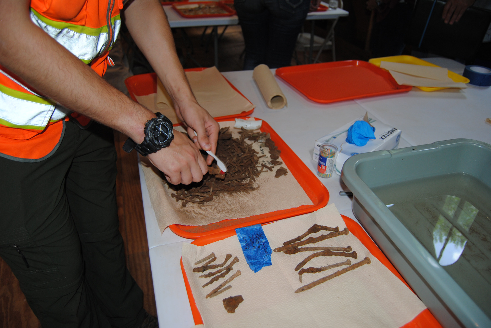
Artifact cleaning, sorting, basic identification, cataloging, data entry, and preparation for long-term curation.
Technical documentation
Site forms, field notes, plan and profile drawings, maps, photography, provenience records, and the documentation required for professional archaeological reporting.
Public archaeology
Communicating methods and findings, engaging diverse audiences, and interpreting Old Cahawba’s complex cultural landscapes.
Career preparation
Professional ethics, fieldwork expectations, teamwork, workplace conduct, résumé development, and employment pathways in CRM and applied archaeology.
Specialized training tracks
Each participant completes one of four tracks alongside the core archaeological training. Applied to research and preservation projects at Old Cahawba, these tracks provide technical experience that can be difficult to obtain through classroom instruction alone.
Select a track to read its fieldwork, methods, and practical skills.
The Ground Penetrating Radar (GPR) Track introduces participants to the scientific principles, field methods, analytical workflows, and interpretive limitations of GPR in archaeological research. Participants work within Old Cahawba’s Historic Downtown, where former streets and town lots preserve buried traces of Alabama’s first capital and the river town that developed around it. This complex archaeological setting provides an opportunity to investigate possible structural remains, landscape features, and areas of subsurface disturbance without immediately resorting to excavation.
Led by experienced geophysical survey specialists, participants progress through the complete survey process—from developing research questions and designing a grid to collecting, processing, visualizing, and interpreting radar data. The track emphasizes the responsible integration of geophysical results with historic maps, surface evidence, excavation data, and other archaeological sources.
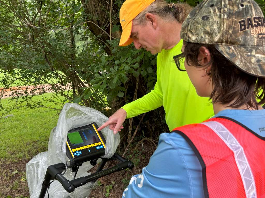
Participants receive instruction and supervised practice in:
- GPR fundamentals: Electromagnetic-wave transmission, reflection, attenuation, and the material contrasts that produce subsurface anomalies
- Survey design: Research questions, grid placement, coordinate control, transect spacing, system configuration, and survey-wheel calibration
- Field operation: Equipment setup, systematic data collection, field notes, quality-control procedures, and troubleshooting
- Data processing: Reviewing raw profiles and applying appropriate corrections, gains, filters, and other processing steps
- Visualization: Producing and evaluating radar profiles, plan-view depth slices, and other outputs used in archaeological interpretation
- Interpretation: Distinguishing potentially significant anomalies from background variation, modern disturbance, and processing artifacts
- Site assessment: Evaluating how soil composition, moisture, surface conditions, target size, depth, and orientation affect survey results
- Archaeological integration: Comparing geophysical anomalies with maps, historical records, surface features, and excavation results while avoiding unsupported conclusions
This track is ideal for participants interested in archaeological remote sensing and non-invasive investigation. Students leave with practical experience in the GPR workflow, a realistic understanding of the method’s capabilities and limitations, and a strong foundation for additional supervised work in geophysical survey.
The Geographic Information Systems (GIS) Track provides a practical, field-to-finish introduction to archaeological mapping, spatial data management, and basic analysis. Working in both laboratory and field settings at Old Cahawba, participants learn how spatial information supports archaeological survey, excavation, cultural resource management, preservation planning, and public interpretation.
Students apply GIS methods to the complex landscape of Alabama’s first state capital, where historic streets, town lots, archaeological sites, cemeteries, environmental features, and modern infrastructure must be accurately documented and managed. Participants gain experience collecting new field data, integrating it with existing maps and records, evaluating its accuracy, and transforming it into clear, professional map products.
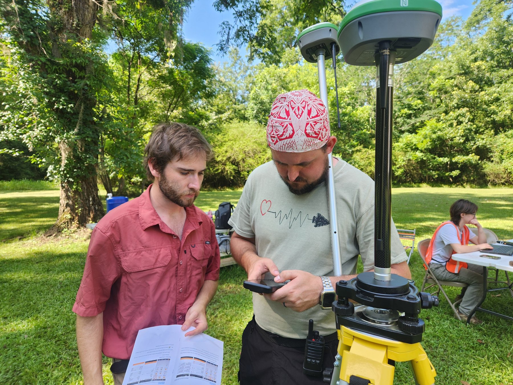
Instruction and supervised practice include:
- GIS fundamentals: Vector and raster data, layers, attribute tables, scale, resolution, and archaeological and environmental applications
- Coordinate systems and data quality: Datums, projections, accuracy, precision, metadata, and the importance of consistent spatial reference systems
- ArcGIS workflows: Introductory use of ArcGIS Pro, ArcGIS Online, and mobile data-collection tools
- Field data collection: Operating a handheld Garmin GPS receiver, a GPS-enabled data-collection tablet, and a survey-grade GNSS base-and-rover system
- Spatial data management: Creating and editing datasets, organizing attribute information, maintaining geodatabases, and conducting quality-control checks
- Mapping and analysis: Querying data, measuring distances and areas, examining spatial relationships, and performing basic overlay and distribution analyses
- Cartographic production: Applying appropriate symbology, labels, legends, scale information, and layout principles to create clear professional maps
- Data integration: Combining field observations with aerial imagery, historic maps, environmental datasets, and archaeological records
GIS is one of the most widely requested technical skills in contemporary CRM. This track is ideal for students, archaeologists, and other cultural-resource professionals who want to understand the complete spatial-data workflow and gain practical experience with equipment and software used in professional archaeological projects.
The Photogrammetry Track introduces participants to Structure-from-Motion (SfM) photogrammetry as a method for creating accurate, measurable, and visually detailed records of cultural resources. Working in Old Cahawba’s field and laboratory settings, students document historic monuments, headstones, architectural elements, and archaeological artifacts before processing their photographs into scaled, high-resolution 3D models with Agisoft Metashape.
Old Cahawba provides an exceptional setting for this training. Its cemeteries, archaeological collections, and surviving historic features represent multiple generations of the community and present varied documentation challenges, including weathered surfaces, fragile materials, complex shapes, changing light, and restricted physical access. Participants learn to design documentation strategies appropriate to each subject while recognizing that digital models support—but do not replace—physical conservation and responsible stewardship.
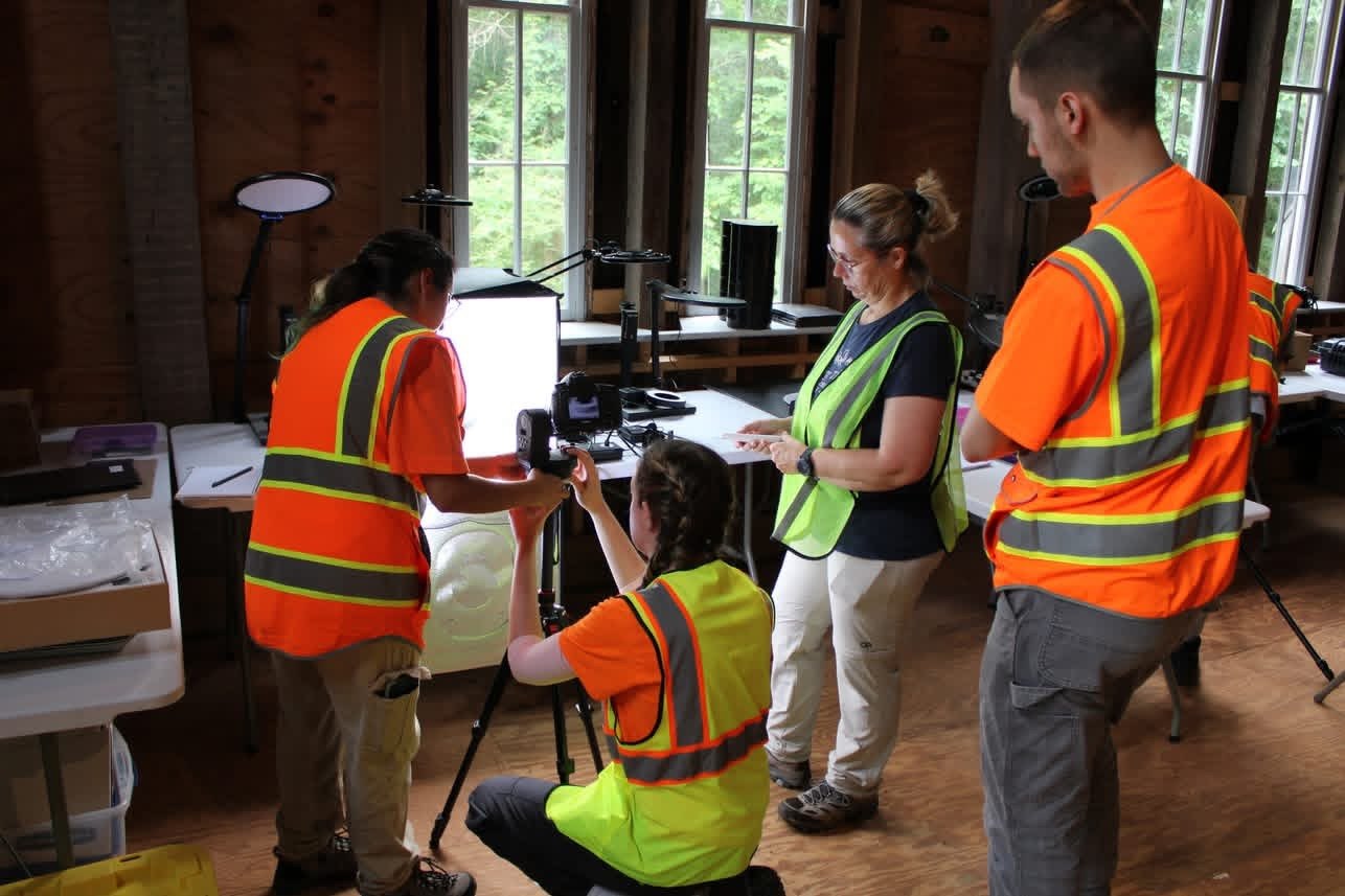
Instruction and supervised practice include:
- Project planning: Defining research and preservation goals, selecting appropriate subjects, and determining the required scale, resolution, and final products
- Photographic documentation: Camera settings, focus, depth of field, image overlap, systematic coverage, lighting, and strategies for difficult surfaces
- Scale and control: Using scale bars, coded targets, reference measurements, and photographic logs to produce reliable and repeatable datasets
- Field and laboratory recording: Documenting monuments and headstones in cemetery settings and photographing artifacts under controlled conditions
- Agisoft Metashape workflows: Image alignment, camera optimization, depth-map and point-cloud generation, mesh construction, texturing, scaling, and export
- Quality control: Identifying gaps, distortion, alignment errors, excessive noise, and other problems that can reduce a model’s accuracy or usefulness
- Digital-data management: File naming, metadata, backups, model cleanup, appropriate export formats, and preparation for long-term preservation
- Research and interpretation: Using 3D models for condition assessment, comparative analysis, measurement, visualization, education, and public interpretation
- Ethical digital practice: Considering cultural sensitivity, ownership, access, privacy, attribution, and the responsibilities associated with publishing heritage data online
This track is ideal for students and professionals interested in digital archaeology, conservation, museum work, cultural resource management, or public interpretation. Participants leave with experience completing the full photogrammetric workflow and a strong foundation for producing responsible digital documentation in professional heritage settings.
The Cemetery Preservation and Documentation Track introduces participants to the legal, ethical, technical, and community-centered practices required to care for historic burial grounds. Working under professional supervision in Old Cahawba’s cemeteries, students learn to document burial landscapes, assess monument conditions, and—when appropriate—clean and undertake limited stabilization of headstones using conservation-compatible methods.
Old Cahawba’s burial grounds preserve the histories of individuals, families, and communities connected to the former state capital and the town that followed it. Participants examine cemeteries as cultural landscapes shaped by monuments, spatial organization, vegetation, pathways, boundaries, family relationships, religious traditions, and changing commemorative practices. The track emphasizes respect for the deceased, descendant communities, and the continued cultural significance of burial places.
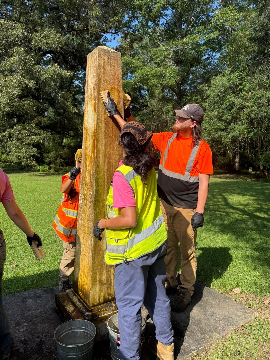
Instruction and supervised practice include:
- Cemetery law and ethics: Applicable burial laws, ownership and access, permissions, professional conduct, cultural sensitivity, and responsibilities to descendants and affiliated communities
- Landscape documentation: Recording cemetery boundaries, grave locations, monuments, pathways, fences, vegetation, and other contributing features
- Condition assessment: Identifying structural instability, biological growth, surface loss, cracking, displacement, previous repairs, and other forms of deterioration
- Material identification: Recognizing stone, concrete, brick, metal, and other monument materials and understanding how each responds to weathering and treatment
- Headstone cleaning: Selecting appropriate tools and conservation-compatible cleaning methods while avoiding damaging chemicals, coatings, and abrasive techniques
- Stabilization principles: Applying minimum-intervention practices, recognizing the limits of field treatment, and determining when specialized conservators are required
- Professional documentation: Preparing condition forms, photographic records, maps, treatment logs, and recommendations for continued monitoring
- Preservation planning: Establishing priorities, treatment phases, maintenance schedules, budgets, risk-reduction strategies, and long-term stewardship goals
- Community interpretation: Presenting cemetery history respectfully and incorporating cultural memory, archival research, and community knowledge into interpretation
The track focuses on non-invasive, above-ground documentation and preservation; it does not involve the excavation or disturbance of human remains. It is well suited to students and professionals interested in cemetery stewardship, historic preservation, public history, cultural-resource management, heritage tourism, or descendant-community engagement. Participants leave with practical experience and an ethical framework for developing responsible, sustainable preservation programs for historic burial places.
Public Archaeology Day
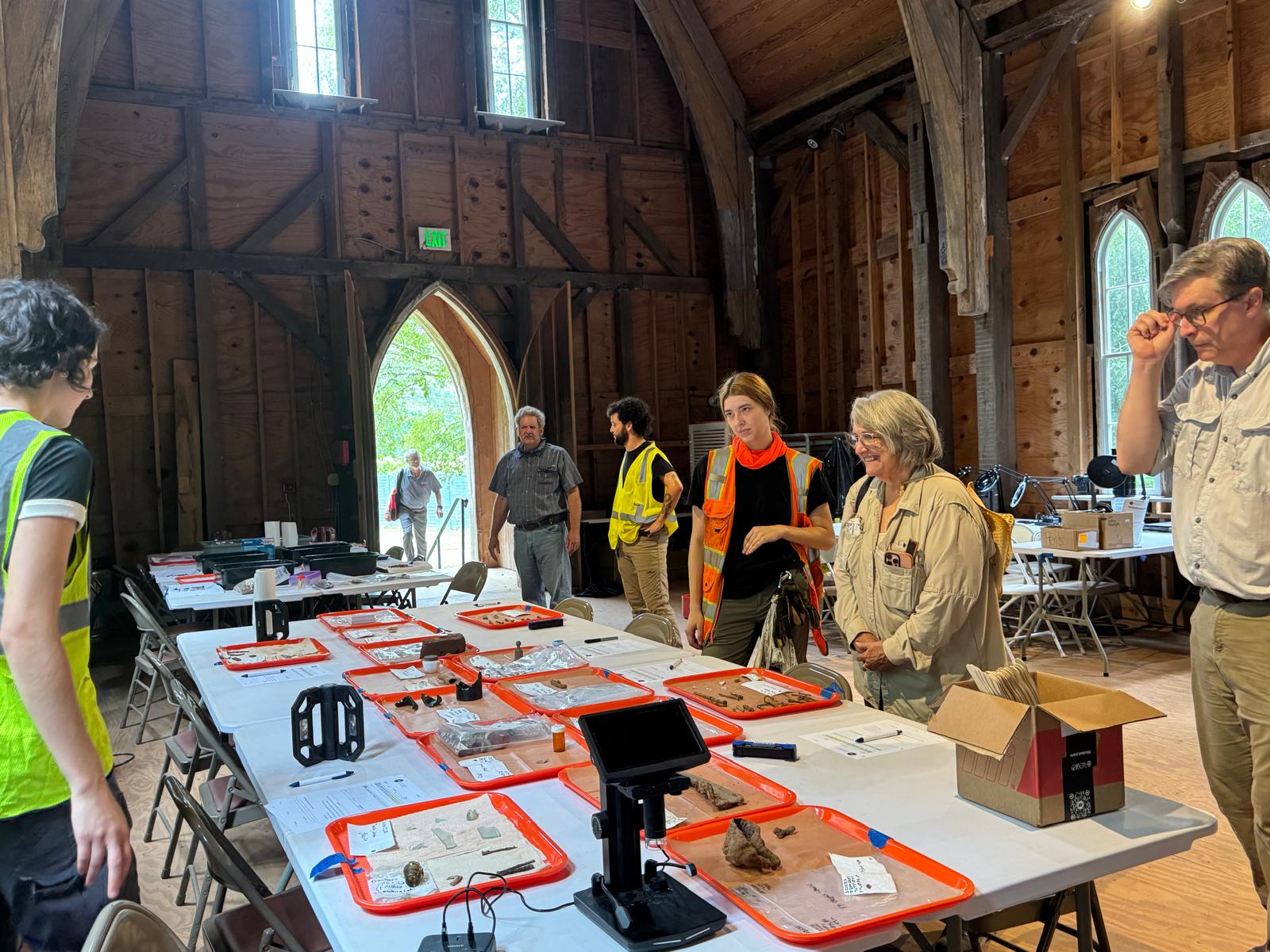
Each session concludes with a Public Archaeology Day led in part by participants. Students present their findings and ongoing research, demonstrate field and laboratory techniques, and help visitors understand how archaeology is expanding knowledge of Old Cahawba and its communities.
Explaining methods, interpreting historic resources, and communicating the significance of discoveries develops the professional communication and public-engagement skills expected in CRM and applied archaeology.
Career-pathways roundtable
Public Archaeology Day also includes a roundtable with professional archaeologists from government agencies, private CRM firms, nonprofit organizations, museums, universities, and historic sites.
Participants can explore different employment sectors, ask practical career questions, and build professional connections that support the transition from training to the workplace.
Completion & professional development
Participants receive a formal certificate of completion issued by the Alabama Historical Commission, alongside practical field experience, specialized technical training, and a fuller understanding of responsible cultural-resource stewardship.
The certificate can support
- Applications for CRM technician positions
- Graduate school portfolios
- University credit through independent study, where applicable
Participants also gain
- Mentorship from experienced CRM archaeologists
- Letters of recommendation, when merited
- Practical skills used in professional CRM work
- Connections with archaeologists across employment sectors
Applications & practical information
Review the syllabus and plan for housing, meals, and transportation.
Questions about the program?
william.henry@ahc.alabama.gov
Site Director’s Office: 334-875-2529
Monday–Friday, 9 am–4 pm Central Time
Visitor Center: 334-872-8058
Every day, 9 am–4 pm Central Time